Borders and Eclipses

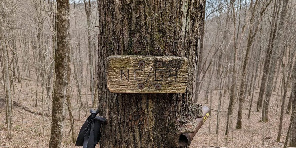
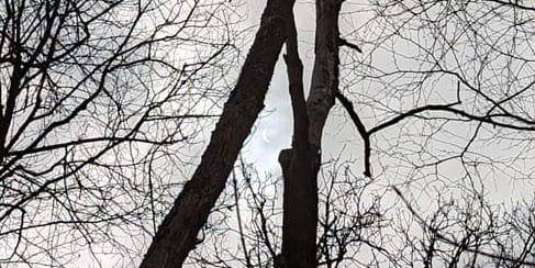
The last leg of Georgia starting at Dicks Creek Gap on April 7 was relatively flat, a welcome change from the daily climbs we'd grown used to. Rain was forecast, so most hikers on the shuttle were resolved to reach the first shelter in North Carolina, Muskrat Creek, about 12 miles away. We crossed the GA/NC border during a partial solar eclipse. This was both a good omen and a welcome source of shade after hiking in the sun all day. We made our toasts and then set out to hike the first three miles of North Carolina.
And what a first three miles it was! Over 1000 feet of elevation condensed into about a mile and a half. This was unrelenting steep uphill, after having just covered the last nine miles of Georgia. For the next three nights I would be sleeping in shelters to stay out of the rain, which would persist for about five days. North Carolina really rolled out the red carpet for us.
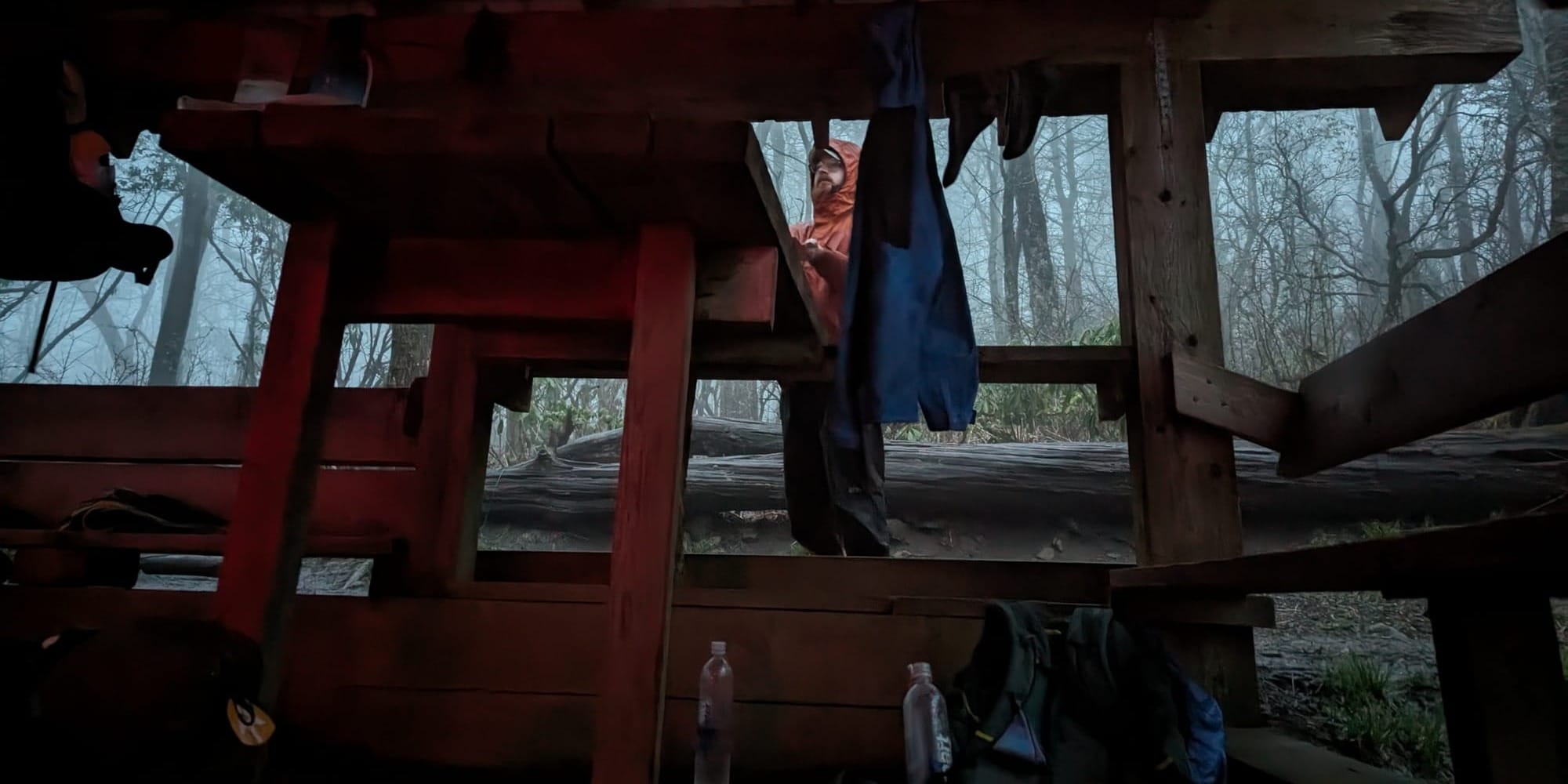
Mice live in the shelters, we were just visiting. Every night I either felt mice crawling around me or saw them jumping over my feet after dinner time. They are very busy, and hikers keep them well fed. By some unwritten law of nature, at least one hiker would be snoring in the shelter every night. You also learn to appreciate differences in the loudness of air mattresses. Even with ear plugs, some of them sounded like motorcycle engines every time they moved.
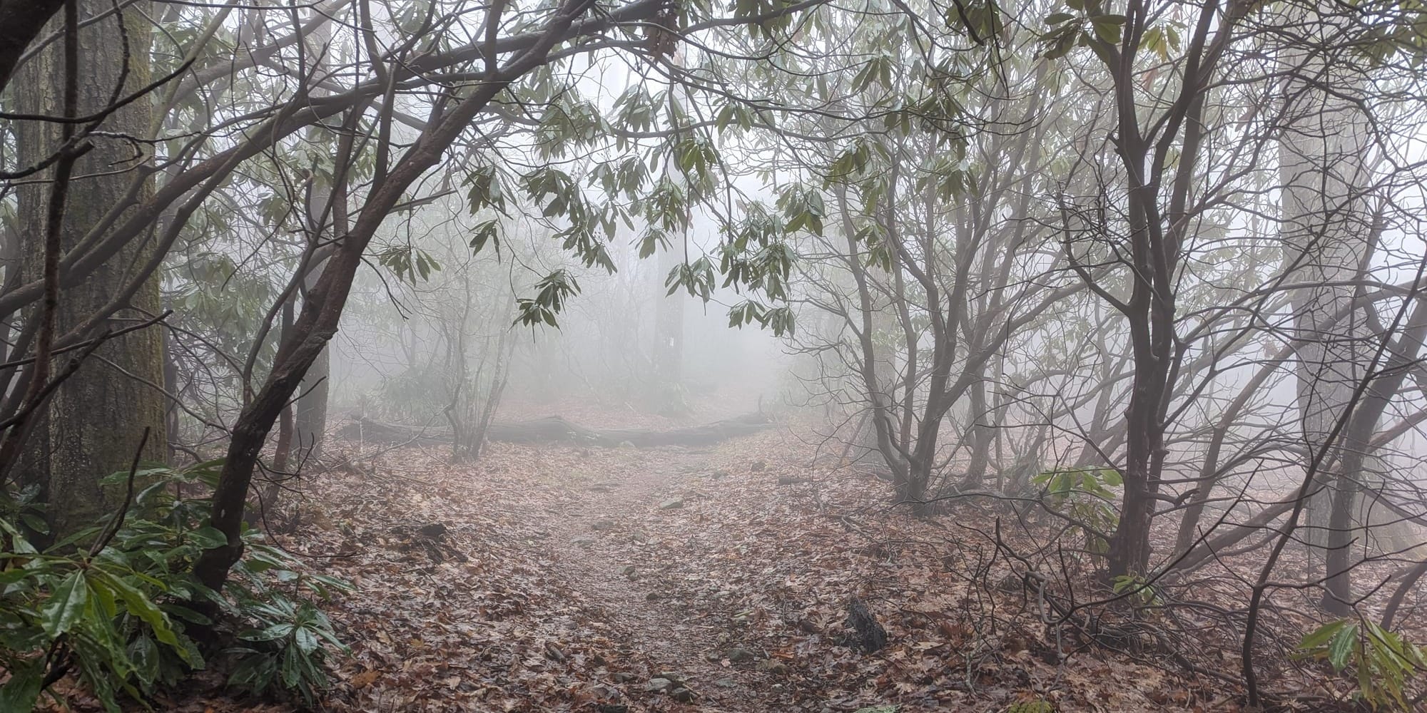
We reached the 100 mile mark on Wednesday the 10th and made more toasts. The peak of Albert Mountain was reached by a long and rocky staircase, the top of the fire tower was sealed, and we were inside the clouds with only a few meters of visibility. Thanks again, North Carolina.
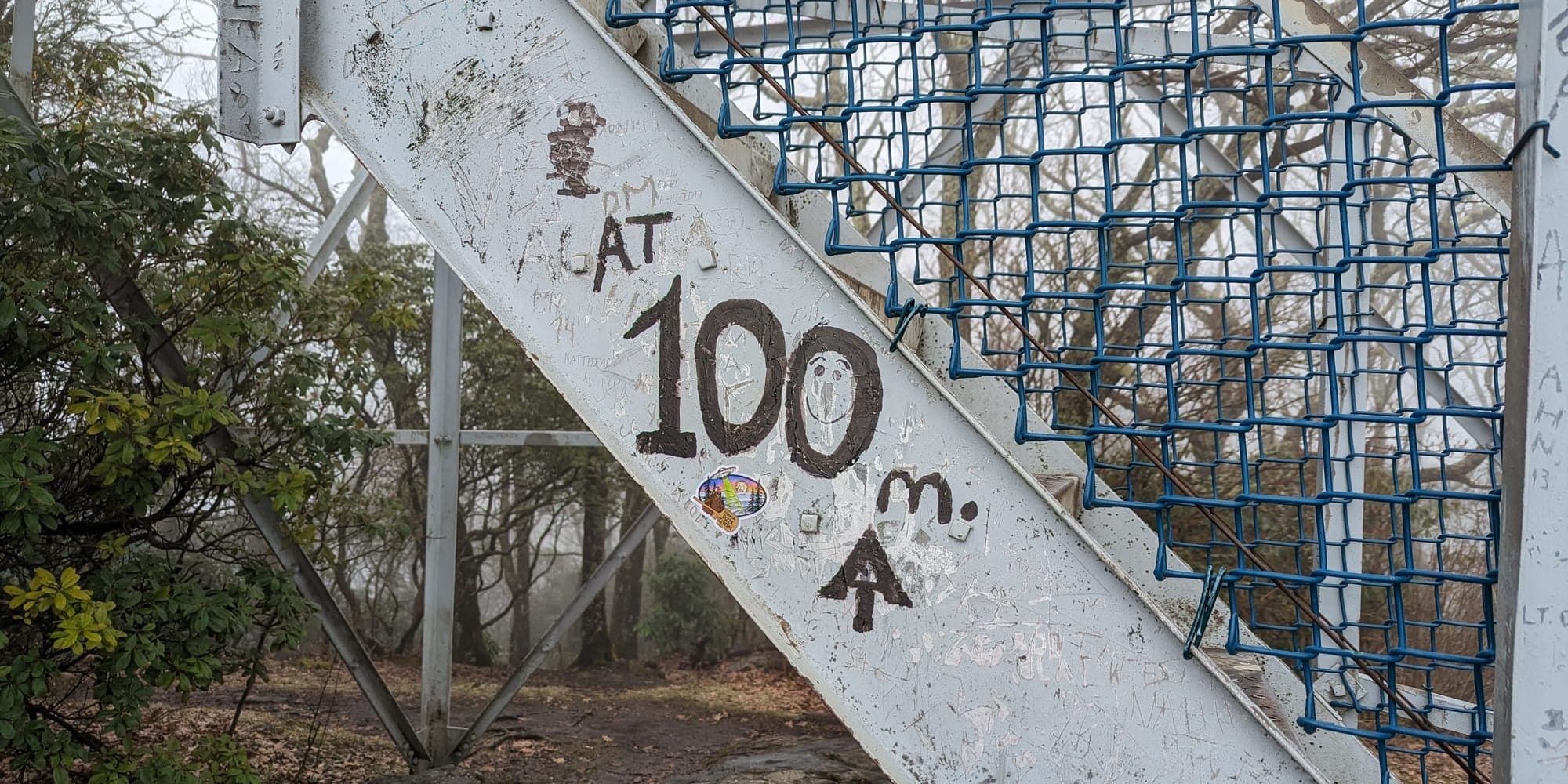
By the 110 mile mark:
- I have never turned on any head lamp or flashlight. I can do everything I need from sunrise to sunset.
- I still have not bought a second fuel canister. I bartered some shortbread cookies and a partial fuel can for a nearly full one at Blue Mountain in Georgia.
- I have accelerated the rate of trail song verse writing and now have over ten verses, including a special 100 mile verse which I will post tomorrow.
- I have spent ten nights in the woods.
- I threw away my third pair of socks in Blairsville. On cold nights I just put on both pairs of socks, on wet days I can keep a pair dry for the nights.
- I've exchanged my Swiss Army knife for a keychain sized version which weighs about 1/4 as much. I've only used the scissors so far.
- I have never applied sunblock or bug spray. My clothes, hat and sun gloves are good enough for the sunniest days, and all of the above are treated with permethrin. I expect I'll be needing the picardin and maybe the bug net starting in Virginia.
On the morning of Thursday the 11th, I rode the Franklin shuttle into town and booked two nights. By now I had hiked four 12 mile days in a row to speed through the rain, so the two zero days still averaged out to my beginning target of 8 miles per day.
I can now characterize the three wilderness legs between town stops:
- The shakedown leg, where I learned that my shoes were wrong and that my mathematically optimized high fat diet was not going to work. More on this later.
- The cold leg, during which it froze every night.
- The wet leg, during which I slept in shelters and everything was permanently damp.
Seems like the next outing should be more stable for a change, so expect more landscape photography next week.